
Liverpool Range Wind Farm Analysis
The challenge for large-scale renewable energy projects is managing a dual threat: protecting the high-value turbine infrastructure from external bushfire spread and mitigating the risk of a fire igniting at the infrastructure itself and spreading into surrounding lands.
The Liverpool Range Wind Farm site, an expansive 68,727-hectare area, is located in a region with a history of catastrophic fire activity, including the 55,000-hectare Sir Ivan Fire in 2017. This requires a proactive strategy to safeguard the 287 proposed turbine assets and surrounding communities..
Demonstrating Mitigate’s Risk Analysis
This case study demonstrates the critical value of the Mitigate platform in both the design and ongoing maintenance of large-scale renewable energy infrastructure, such as wind farms.
This exercise allows FiSCi to demonstrate that Mitigate moves asset management from broad-scale guesswork to a precise, data-driven strategy that ensures operational continuity and community protection.
Disclaimer: This analysis was not a paid or affiliated engagement. FiSci chose the Liverpool Range Wind Farm project as a public-facing example to internally test and showcase the robust predictive and prescriptive capabilities of our Mitigate platform in a high-consequence infrastructure environment.
Site Analysis
The Mitigate tool visualizes the proposed wind turbines and predicted fuel load across the entire site against the project's single major historical fire, providing a clear visual baseline for risk assessment.

A major historical fire (Sir Ivan Fire, 2017) burned 55,000 hectares, destroying 35 homes and 133 outbuildings while killing over 2,100 head of livestock and domestic animals
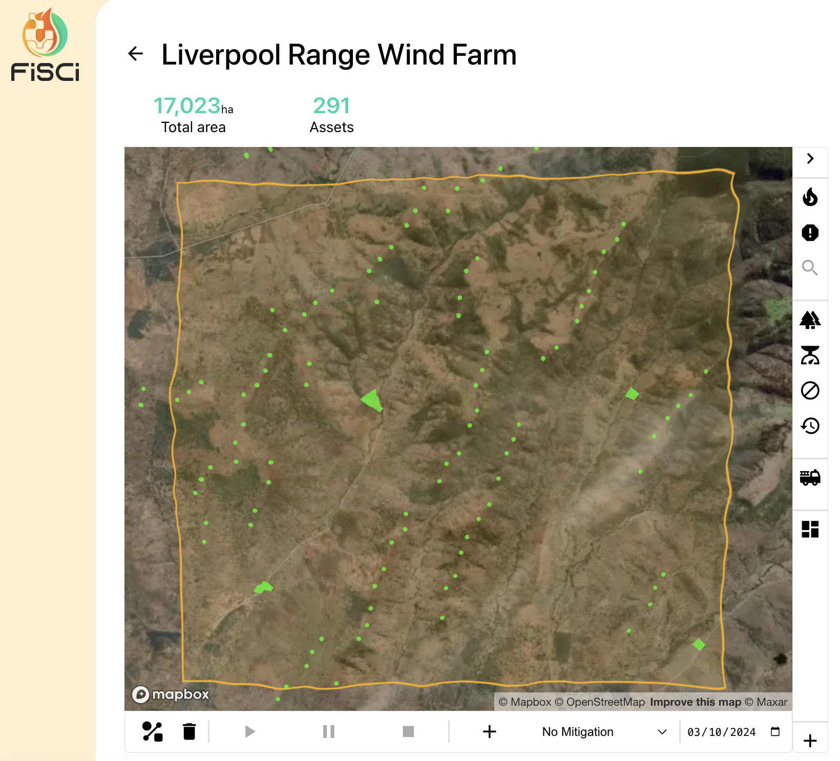
The proposed turbine sites (small green circles) and other assets including houses and sheds

Undulating terrain causing increased uphill fire activity.

Moderate fuel loads, primarily consisting of grassy understory ranging between 5 to 20+ t/ha
Threat to Infrastructure
The simulated analysis involved a rigorous assessment of fire risk to the proposed wind farm infrastructure under catastrophic weather conditions to determine asset resilience. This was achieved by setting up a grid of potential ignition locations across the region. A fire spread simulation was run from each of these points, using extreme environmental parameters. This extensive simulation quantified which specific turbines were most likely to be impacted by external fires and identified the ignition points that would result in the largest, most dangerous fires, providing a complete risk profile for the asset network.
A simulated prescribed burn treatment to reduce the small pocket of denser fuel and subsequent risk analysis within Mitigate revealed that the fire risk to the wind turbines in the central north of the site was significantly reduced. This demonstrates the platform's ability to precisely model the positive impact of a planned treatment, confirming that a targeted fuel reduction strategy is highly effective at increasing the resilience of high-value assets
There is a a small pocket of denser fuel load in the central North of the site which is putting a number of wind turbines at risk should it ignite


Threat From Infrastructure
The analysis focused on assessing the risk from infrastructure by running a second set of fire spread simulations across the turbine network under the same catastrophic conditions. The purpose was to identify specific high-consequence ignition points—the turbines which, if they were to cause a fire (e.g., due to equipment failure), would result in the largest and most destructive fires across the entire project area. This simulation is critical for prioritising maintenance and mitigation efforts where the ignition risk carries the highest potential for external damage.
If a fire originates from the turbine circled, the turbines to the south east are in danger
If a fire originates from the turbine circled, then the turbines to the south-west are in danger of being hit by the subsequent fire front


The shed to the south of the turbine at the top of the peak will likely be impacted if a fire ignites at the highlighted turbine
The buildings to the south are in danger of impact if the turbine to the north causes a fire

